

Severe storms, flash flooding threaten Northeast through Friday: Forecast timeline
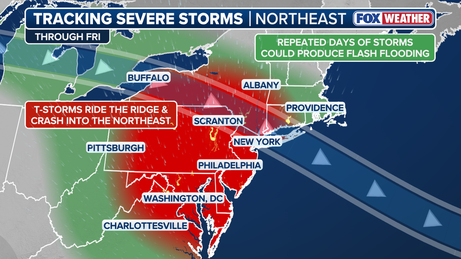
WASHINGTON, D.C. - A multiday severe-weather stretch is expected to continue across the Northeast and Mid-Atlantic, with Philadelphia, New York City and Washington, D.C., each facing the risk of strong to severe thunderstorms in the days ahead.
The main concerns include damaging wind gusts, large hail, frequent lightning and flash flooding. A tornado or two also cannot be ruled out in the strongest storms, according to the FOX Forecast Center.
What happened Tuesday?
What we know:
Severe thunderstorms moved across Pennsylvania, New Jersey and New York on Tuesday, producing damaging wind gusts, heavy rain and power outages.
FOX Weather reported wind gusts as high as 70 mph in parts of Delaware, Pennsylvania and New Jersey. Training storms also prompted flash flood warnings in eastern Pennsylvania.
Wednesday: Philadelphia and NYC face storm, flood concerns
Timeline:
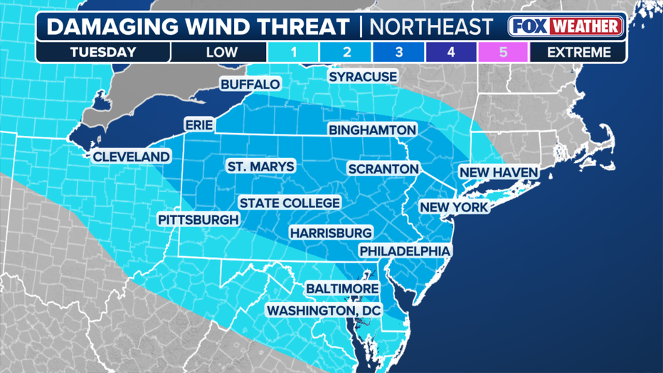
Scattered storms could already be underway Wednesday morning across Pennsylvania and areas to the southeast before additional storms redevelop later in the day.
The FOX Forecast Center said Wednesday could bring the greatest potential for damaging wind reports and power outages during this multiday stretch. Large hail and a couple of tornadoes are also possible in the strongest storms.
New York City is included in a Level 2 out of 4 flash-flood threat Wednesday, as repeated downpours could quickly overwhelm poor-drainage and low-lying areas.
Thursday: Severe threat shifts toward DC
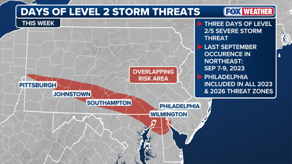
The severe-weather threat is expected to shift farther south Thursday, putting Washington, D.C., and other parts of the Mid-Atlantic in focus.
Storms could develop along leftover boundaries from earlier rounds of rain and thunderstorms. Damaging winds remain the main concern.
Friday: Another round possible
Another round of storms is possible Friday as the broader pattern continues along the East Coast.
The most significant threat may shift farther south into the Mid-Atlantic and eventually the Carolinas, though forecast details can still change.
What to watch for
What's next:
People across the region should keep an eye on forecast updates and have more than one way to receive weather alerts.
Avoid driving through flooded roads, and move indoors when thunder is heard. Strong wind gusts can bring down tree limbs and power lines, even outside the heaviest rain.
The Source: This article was written using information from the FOX Forecast Center.