

Heat wave bringing triple-digit heat indexes to DC region this week
Triple-digit heat index expected to return this week across the region
Scattered evening showers will taper off tonight before temperatures and humidity surge across the D.C. area. Highs are set to reach the 90s, with heat index values pushing past 100 degrees through Tuesday, Wednesday and Thursday.
WASHINGTON, D.C. - A heat wave is building across the region Monday, setting the stage for oppressive midweek temperatures before relief arrives just in time for the holiday weekend.
What we know:
A heat dome expanding from the west will dominate the weather pattern through Thursday, pushing temperatures well above late-summer averages.
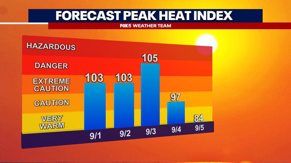
Triple-digit heat indexes
By the numbers:
Monday morning temperatures are starting on a warm note, with hot and sticky conditions expected by the afternoon as daytime highs climb into the low 90s. While a stray pop-up shower or thunderstorm is possible, the vast majority of the region will remain dry with a slight increase in cloud cover later in the day.
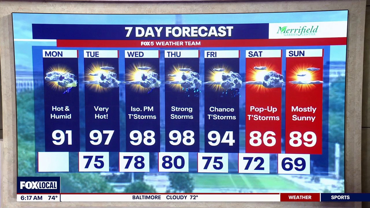
Tuesday, Wednesday, and Thursday will serve as the core of this heat wave, with actual air temperatures climbing into the mid-to-upper 90s,
Dew points hovering in the upper 60s and low 70s will create stifling humidity. When combined with the ambient heat, the heat index will reach 100–105 degrees during peak afternoon hours.
Labor Day relief
What's next:
The intense heat will break by the end of the workweek. Friday marks the beginning of a pattern shift, ushering in a significantly cooler Saturday and Sunday.
Daytime highs will retreat to the low-to-mid 80s, dropping the oppressive humidity and providing highly favorable weather for outdoor holiday weekend plans.
The Source: Information from this article was provided by the FOX 5 weather team.