

DMV weather: Severe thunderstorms cause property damage, power outages
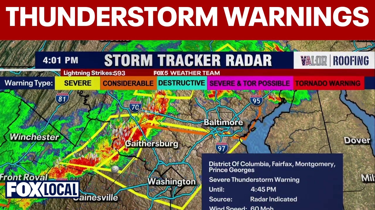
Thunderstorm warnings issued in DC, along with Montgomery, Fairfax and Prince George's counties
Severe thunderstorm warnings have already been issued for several counties in Maryland and Virginia, along with Washington D.C.
WASHINGTON - A hot and humid Monday across the Washington, DC region, with temperatures climbing into the mid‑90s as thunderstorms cause ground stops at all area airports and bring potentially dangerous conditions.
Over 21,000 BGE customers lose power after severe storms hit central Maryland
Severe thunderstorms on Monday evening caused widespread damage across BGE's service area, leaving nearly 21,700 customers without power, according to the utility company.
Baltimore County, Baltimore City and Howard County were the hardest hit, though crews have already restored service to 12,800 affected customers.
BGE expects to restore power to 80% of impacted customers by Tuesday night, with the vast majority of remaining outages resolved by Wednesday evening.
Falling trees strike homes in Rockville and Bethesda, injuring 1
Monday afternoon storms sent trees crashing onto homes across Montgomery County, causing injuries and property damage, according to the Montgomery County Fire and Rescue Service.
In Rockville, an adult male was hospitalized with non-life-threatening injuries after a tree collapsed onto a Maxim Lane front porch, though he managed to self-rescue.
Shortly after in Bethesda, a tree struck a home on West Cedar Lane, triggering a basement outlet fire that cut power and displaced two adults.
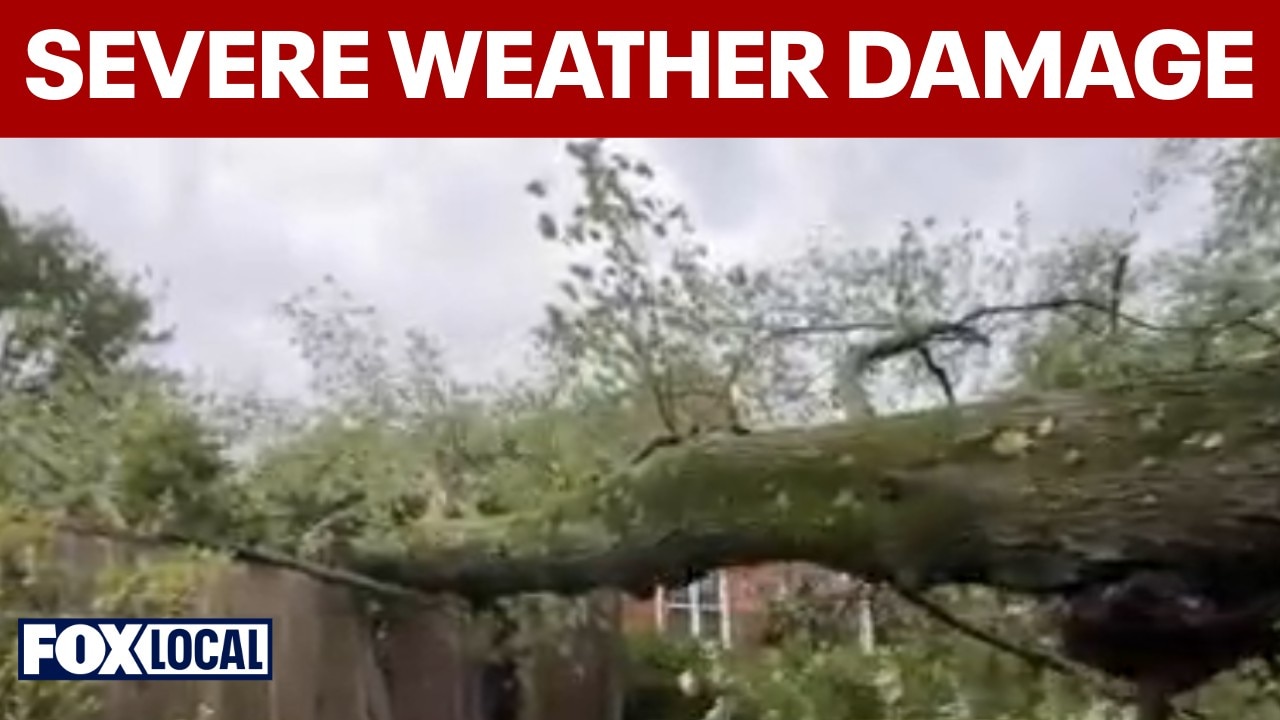
Severe weather causes significant damage to homes in Maryland
FOX 5 D.C.’s Josh Rosenthal spoke with witnesses after a tree fell onto a home in Bethesda.
Severe Thunderstorm Warning until 6:15 p.m.
Charles County.
Flash Flood Warning until 6:15 p.m.
Frederick County.
Severe Thunderstorm Warning until 6 p.m.
Anne Arundel County
Severe Thunderstorm Watch until 9 p.m.
Fauquier County, City of Manassas, Prince William County, City of Fredericksburg, City of Alexandria, Stafford County, City of Fairfax, Fairfax County, Arlington County, Montgomery County, Anne Arundel County, Charles County, Prince Georges County, District of Columbia.
Ground stops at DC area airports until 5:45 p.m.
Ground stops have been issued at DCA, BWI and IAD.
What we know:
By mid‑ to late afternoon, summer thunderstorms may develop, some capable of becoming strong or severe. A few isolated storms could pop up as early as 2 or 3 p.m., but the better chance arrives toward the end of the evening commute and into the night. Damaging wind gusts, hail and heavy downpours are the primary concerns, especially with saturated ground increasing the risk of localized flooding.
A slight risk for severe weather covers the District and areas north, with a marginal risk extending southward. Storms may linger past sunset before gradually tapering overnight.
Highs reach about 95 degrees Monday, with heat index values well above 100. Tuesday brings similar conditions with heat, humidity and storm risks late in the day. The D.C. region stays in the 90s through the end of the week before a break in the heat and humidity arrives closer to the weekend.
Monday Storm Threat Timeline
This Afternoon
- A chance of showers and thunderstorms after 4 p.m. High near 94.
Tonight
- A chance of showers and thunderstorms before 7 p.m. Mostly cloudy, with a low around 75.
Tuesday
- A chance of showers and thunderstorms after 2 p.m. Partly sunny, high near 90.
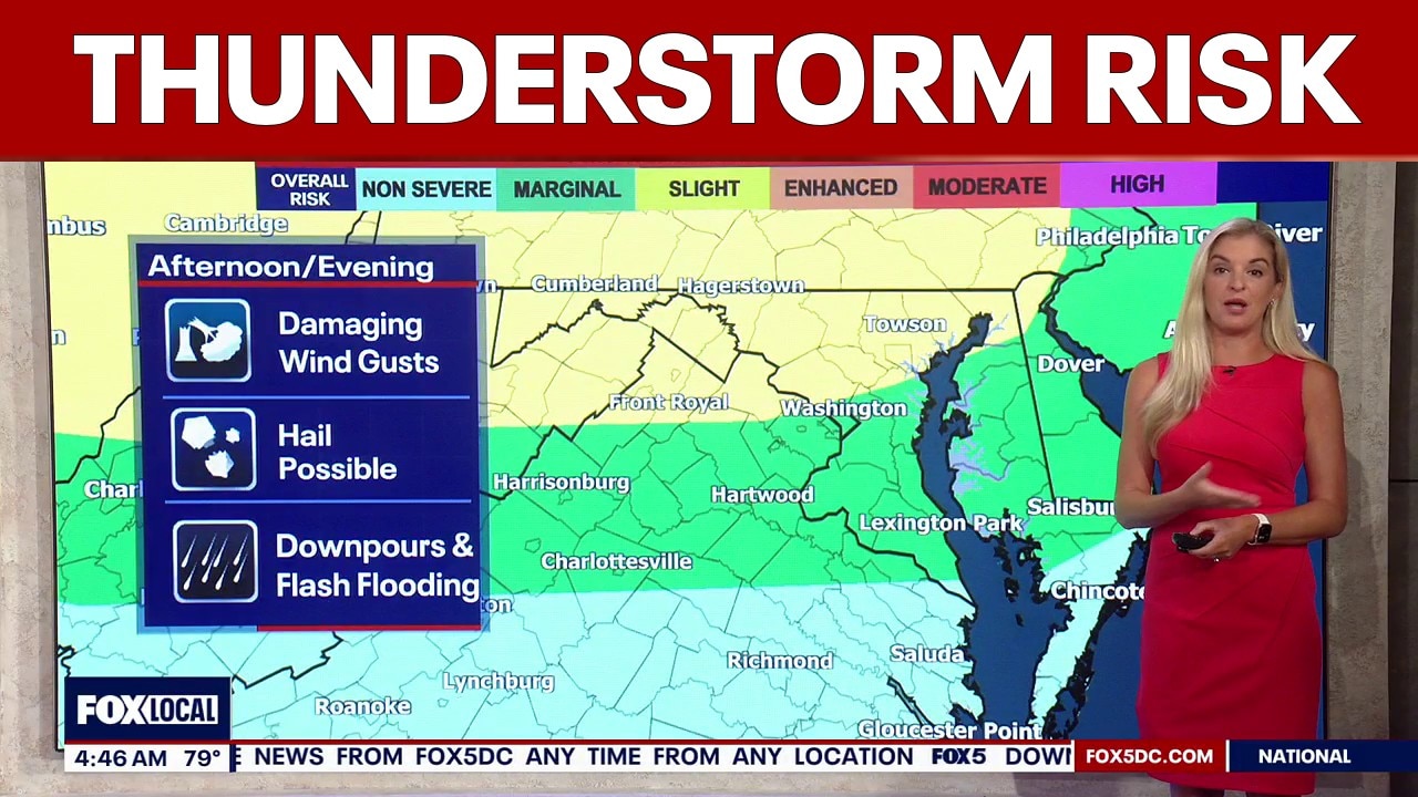
DC weather: Thunderstorm risk Monday with highs in the mid-90s
A risk of thunderstorms across the Washington, D.C. region on Monday with highs in the mid-90s.
The Source: Information in this article comes from the FOX 5 Weather Team and the National Weather Service.