

DC region under risk for strong to severe storms Sunday

FOX 5 Weather forecast for Sunday, June 12
Gwen Tolbart has your FOX 5 Weather forecast for Sunday, June 12
WASHINGTON - Sunday will be the perfect day to stay inside across the D.C. region as it's expected to be hot and muggy with strong storms possible.
Download the FOX 5 Weather App
Sunday morning starts with scattered showers, some isolated thunderstorms especially south of the DC region, and temperatures in the 50s and the 60s.
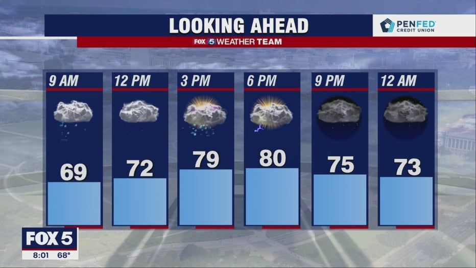
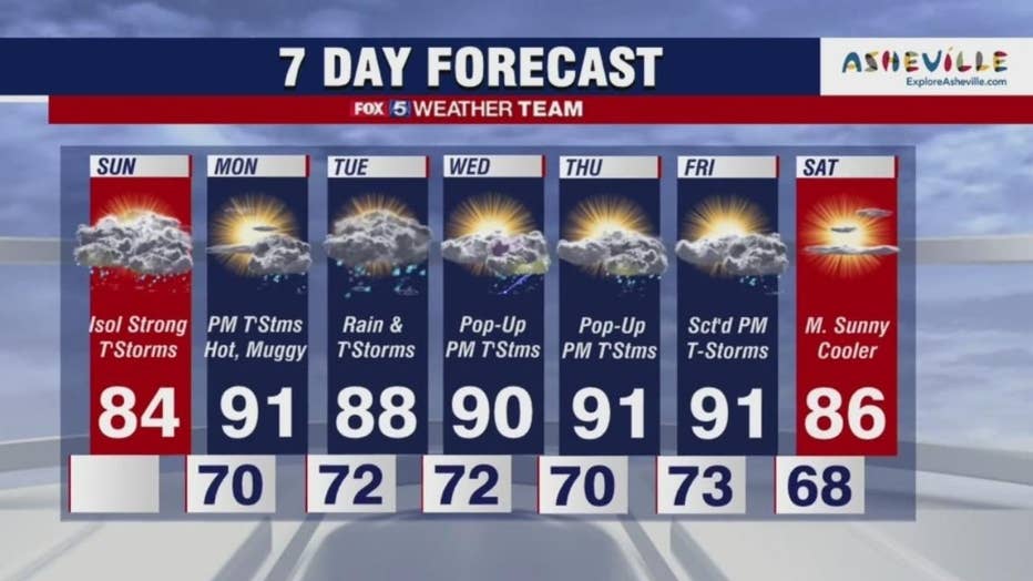
The morning showers and storms are expected to clear out of the region by midday, giving us a slight break in the action before possible storms pick up again in the afternoon. The afternoon will be much warmer than yesterday thanks to the high humidity and expected temperatures in the mid-80s.
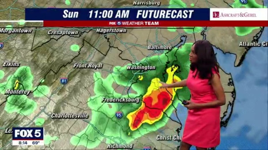
The amount of sun we get with the break will be a leading factor determining the strength of the storms in the afternoon. Greater sunshine will make the atmosphere more destabilized increasing chances that we get strong to severe storms. Those storms are expected to move through the D.C. region between 3 and 7 p.m. Sunday.
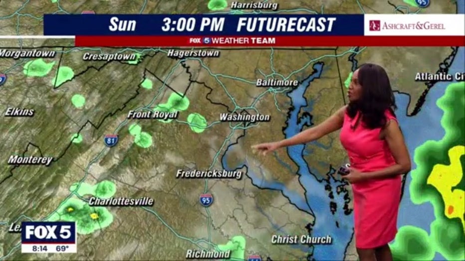
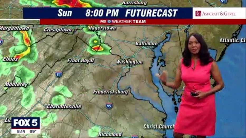
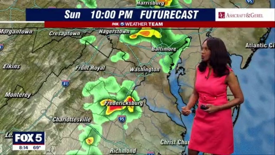
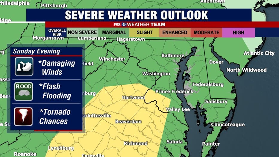
The Storm Prediction Center has placed most of the D.C. region under a marginal risk for Severe weather for today. This risk means the area could experience flash flooding, damaging winds, hail, and some tornado chances. Some areas to the south, including parts of Charles & Prince William County, are under a slight risk for severe weather. The storms could also lead to a severe thunderstorm watches or warnings being issued later in the day, so stay with the FOX 5 weather team for updates.
The storms will clear out after sunset, setting up a clearer but hotter Monday with temperatures back up into the 90s, add to that the humidity and it will be uncomfortable.
Stay with FOX 5 on the app and online for weather updates:
Get the latest FOX 5 forecast here.
Check the latest Closings and Delays
Download the FOX 5 DC News App for Local Breaking News and Weather
Download the FOX 5 Weather App
Check the latest weather radars
Stay up to date with the FOX 5 Weather Team on Twitter:
The high temperatures and humidity will hang around the D.C. region most of the week with several days expected to be near or in the 90s. Frontal systems and the high heat will help keep us in an unsettled weather pattern and leave us with storm chances daily Tuesday through Friday.
Download the free Fox5 Weather App to track the storms with real-time radar.