

DMV weather: Region braces for power outages, hazardous travel as severe storms arrive Monday
WASHINGTON - The Washington, D.C., region is bracing for possible power outages as a dangerous line of storms continues to sweep through central Maryland, northern Virginia and the District on Monday. The severe thunderstorms, driven by a strong cold front, moved into the area during the late morning and quickly intensified.
The FOX 5 Weather team said the storms that passed through delivered damaging winds and heavy downpours, and the system has already triggered numerous Tornado Watches, Tornado Warnings and Severe Thunderstorm Warnings across the region.
Tornado Watches, Warnings and Severe Thunderstorm Warnings issued Monday
The National Weather Service issued Tornado Watches, Warnings and Severe Thunderstorm Warnings across Washington, D.C., and parts of Maryland and Virginia on Monday as a fast moving storm system pushed across the metro area.
DMV prepares for hazardous conditions
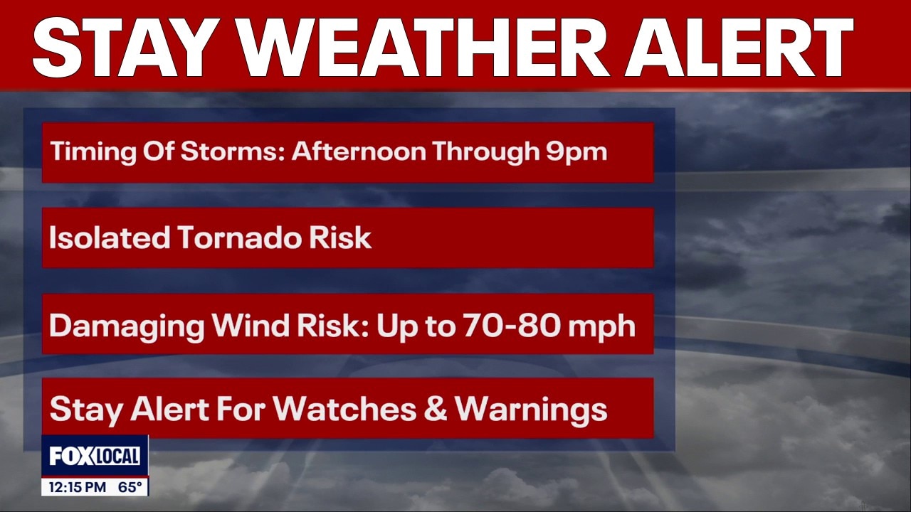
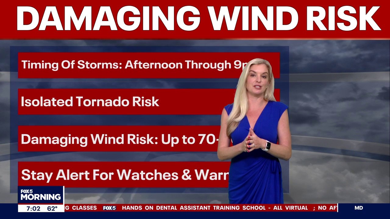
The D.C. region faces the potential for power outages and hazardous travel Monday as a line of severe thunderstorms moves in, bringing damaging winds, heavy rain and even the risk of an isolated tornado.
Additional wind damage is possible later this afternoon, with gusts potentially reaching 70 to 80 mph—strong enough to down trees, damage structures and cause widespread power outages.
Washington, D.C. and numerous parts of Maryland and Virginia remain under a Tornado Watch until 7 p.m.
A Wind Advisory remains in effect for parts of northeastern Maryland from 2 p.m. to 10 p.m., where strong, non‑thunderstorm wind gusts could also produce isolated damage. Even outside the strongest storms, afternoon winds may be powerful enough to bring down branches or unsecured objects.
RELATED: Preparing for a power outage during extreme weather
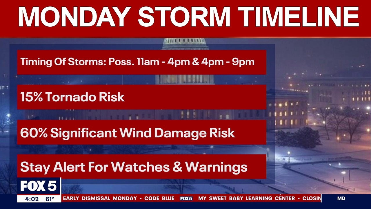
Severe weather expected, Monday storm timeline
Severe thunderstorms are expected to move across the Washington, D.C. region Monday, bringing damaging winds, heavy rain and a chance of an isolated tornado.
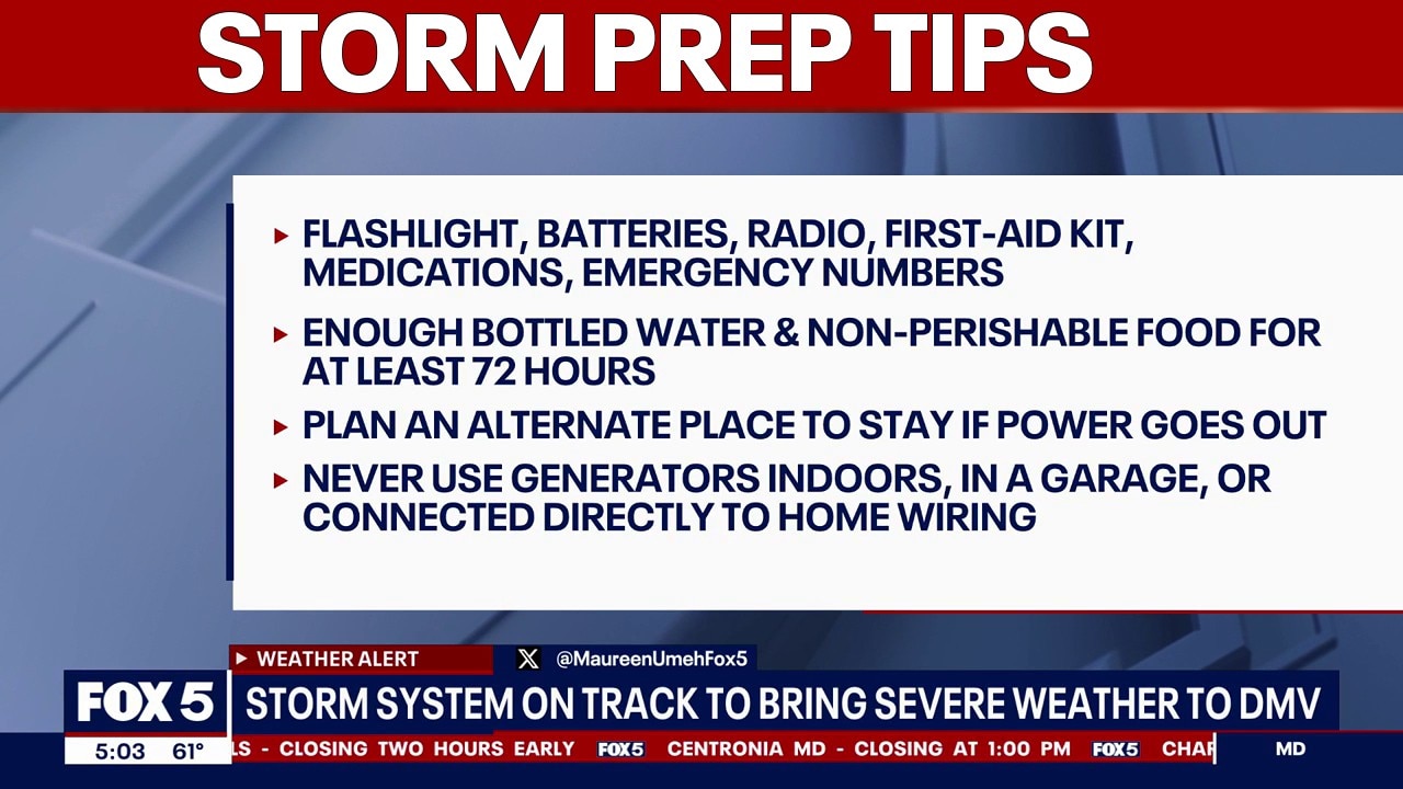
Safety tip for traveling during severe weather (NHTSA)
Use extra caution when driving in rain
- Reduced visibility and slick roads make it harder to react quickly.
Slow down and increase following distance
- Wet pavement reduces traction, and every vehicle handles differently in slippery conditions.
Avoid flooded roads ("Turn Around, Don’t Drown")
- Just 12 inches of moving water can carry away most cars, and two feet can sweep away trucks and SUVs.
Watch for pedestrians and cyclists
- Low visibility in heavy rain or darkness makes it harder to see people sharing the road.
Check conditions before you go
- Review weather, road closures, and traffic updates; adjust routes if needed.
Plan your travel and route
- Know alternate paths and evacuation routes if conditions worsen.
Stock your vehicle with emergency supplies
- Keep an emergency kit ready, including a fully charged phone in case you need help.
DC weather: Severe storms Monday with damaging winds, tornado risk
The most active window for severe weather is expected between 11 a.m. and 9 p.m., when two rounds of storms could move through.
Severe Weather Timeline for Monday
Early morning (before 9 a.m.)
Roads remain wet from overnight storms; gusty winds and temperatures in the upper 50s to low 60s. Additional showers continue to move in from the south, tied to the same system prompting severe thunderstorm watches farther down the region.
Late morning (11 a.m.–12 p.m.)
Severe weather threat ramps up as warm, unstable air ahead of the cold front fuels storm development. Conditions become favorable for damaging winds and an isolated tornado.
Midday (around 12 p.m.)
First round of storms moves in, capable of blinding downpours, strong wind gusts and a brief tornado threat.
Afternoon (12–5 p.m.)
Periods of heavy rain and gusty winds continue. Travel disruptions become more likely as storms track north into the D.C. area.
Evening (5–9 p.m.)
Second line of storms forms along the cold front, bringing another burst of damaging winds. A few wet snowflakes may mix in on the back edge as colder air rushes in.
Late night (after 9 p.m.)
Storms exit the region. Temperatures plunge toward the freezing mark, setting up a cold and breezy Tuesday.
The timing of the storm has led to the following school closings and delays.
Stay with the FOX 5 Weather Team for the latest forecast updates. The FOX LOCAL app is your source for live FOX 5 DC weather updates. Click here to download.
The Source: Information in this article comes from the FOX 5 Weather Team and the National Weather Service.