

Damaging winds and flash flooding threat push into DC, Maryland, and Virginia
WASHINGTON, D.C. - A massive storm system stretching across a 1,000-mile corridor of the country is tracking eastward, threatening D.C., Maryland, and Virginia with severe thunderstorms, damaging winds, and localized flash flooding.
What's driving the storms
What we know:
The multi-state weather front is being driven by a slow-moving cold front tapping into deep tropical moisture pulled northward from the Gulf of Mexico.
As the front pushes toward the East Coast, it brings prime conditions for severe thunderstorm development across the Mid-Atlantic.
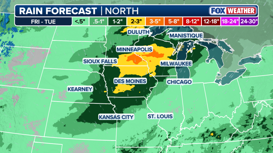
Rain expected through Friday. (FOX Weather)
What to expect in the DMV
For D.C., Maryland, and Virginia, the primary threat from the incoming weather system will be strong to severe thunderstorms capable of producing damaging wind gusts exceeding 60 mph.
Because the system is drawing up heavy tropical moisture, intense downpours could quickly lead to flash flooding in low-lying, urban, and poor-drainage areas. Portions of the central Appalachians and Mid-Atlantic face elevated flood risks as the rain settles over saturated ground.
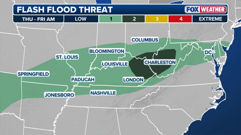
Flash flood threat for Thursday. (FOX Weather)
What's next:
The cold front will continue tracking through the Mid-Atlantic, keeping wet, unsettled weather in the forecast across the DMV. Residents are urged to monitor local radar, secure outdoor objects ahead of high winds, and remain cautious during evening commutes.
The Source: This article was written using information from FOX Weather.