

Fairfax County residents can now track active police calls, drones and helicopters online
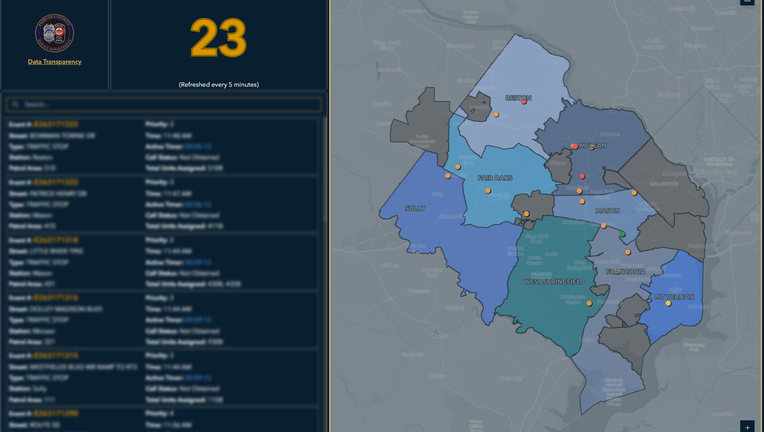
FAIRFAX COUNTY, Va. - Northern Virginia residents wondering why patrol cars are on their street or a police helicopter is circling overhead now have a new way to check what is happening in their neighborhood.
On Friday, Nov. 13, the Fairfax County Police Department introduced three public-facing online dashboards designed to give community members a closer look at daily police activity and aviation operations across the county.
How the dashboard works
What we know:
The new Calls for Service Dashboard provides a near real-time look at active police responses across Fairfax County, displaying the general nature of each incident alongside markers showing whether air support is involved.
According to the department, the dashboard includes several key features:
- Five-minute updates: Information refreshes every five minutes to show ongoing police activity.
- Scene-to-clear visibility: Calls appear on the map once the first responding police unit arrives on scene and remain visible until the last assigned unit clears the incident.
- Aviation icons: A helicopter or drone icon appears whenever one of those units is assigned to a call. That icon remains on the listing until the call is closed, even if the aircraft leaves the scene earlier.
- Midnight reset: The dashboard resets every day at midnight. Any calls still active at midnight are cleared from the display and do not carry over to the next day.
What to keep in mind about preliminary data
Big picture view:
Police emphasized that information shown on the Calls for Service dashboard is preliminary and can change as officers investigate on scene.
Call takers and dispatchers assign an initial call type based on the information available when a call first comes in. While officers and dispatchers may update details as a response unfolds, those changes are not always reflected on the public dashboard before the call closes.
Because of that, the department noted that displayed call types should not be treated as confirmed crimes or final classifications, nor should the dashboard be used to gauge neighborhood crime trends. Residents looking for official crime statistics and historical reporting data are directed to FCPD's Open Data Portal.
Tracking police drones and helicopters Alongside the active call map, police highlighted two historical aviation tools: the Drone as First Responder (DFR) Missions Dashboard and the Police Helicopter Missions Dashboard.
Both dashboards feature deployment records dating back to Oct. 1, 2026, showing the mission type and the associated police district or fire station for each flight. The department said the tools are meant to help residents see how drones and helicopters are used to support public safety operations across Fairfax County.
Police also reminded residents that they can voluntarily register home or business security cameras through Connect Fairfax County, a program that lets detectives identify nearby cameras when investigating crimes or searching for missing people.
What we don't know:
While the Fairfax County Police Department outlined the core features of the new dashboards, the department did not specify how precisely incidents are mapped on the Calls for Service display—such as whether locations are shown at the block level or generalized by neighborhood to protect privacy.
Police also did not state whether certain sensitive calls, such as domestic disputes, medical emergencies, juvenile cases or active tactical operations, are automatically filtered out from public view.
Additionally, while the drone and helicopter dashboards include historical records dating back to Oct. 1, 2026, FCPD did not say whether older flight data will eventually be added or disclose the cost of developing and maintaining the platforms.
The Source: This article was written using information from the Fairfax County Police Department.