

Heat, humidity back Wednesday with strong chance for afternoon and evening storms; Flash Flood Watch issued for parts of DC region

Heat, humidity back Wednesday with strong chance for afternoon and evening storms
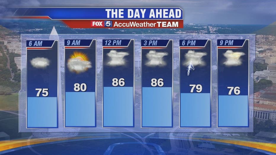
The heat and humidity are back Wednesday along with the strong possibility of storms moving into our area later this afternoon and evening. FOX 5's Mike Thomas says the morning hours look clear with highs near 90 degrees. Plenty of humidity will make it feel even warmer.
WASHINGTON - The heat and humidity are back Wednesday along with the strong possibility of storms moving into our area later this afternoon and evening. FOX 5's Mike Thomas says the morning hours look clear with highs near 90 degrees. Plenty of humidity will make it feel even warmer.
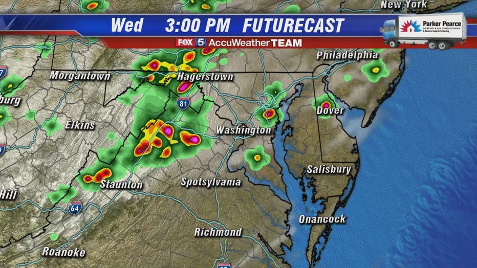
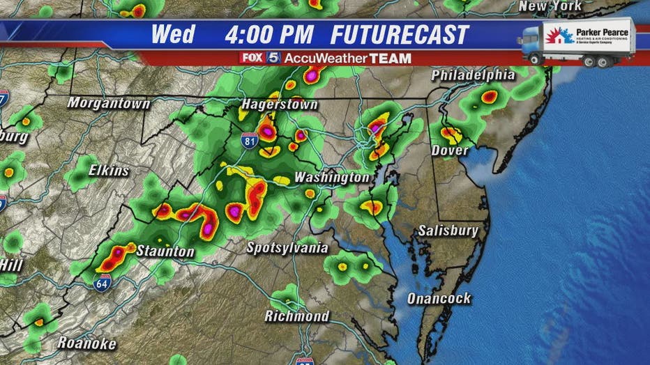
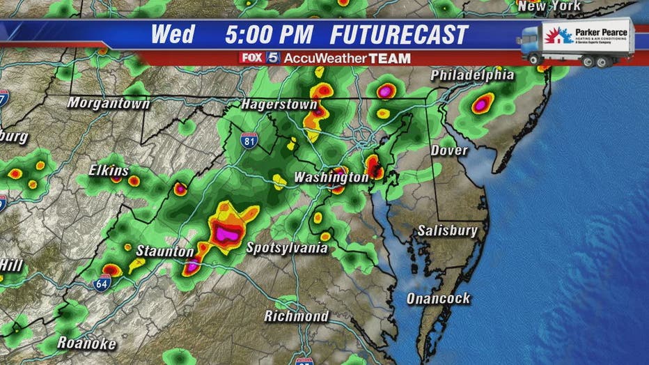
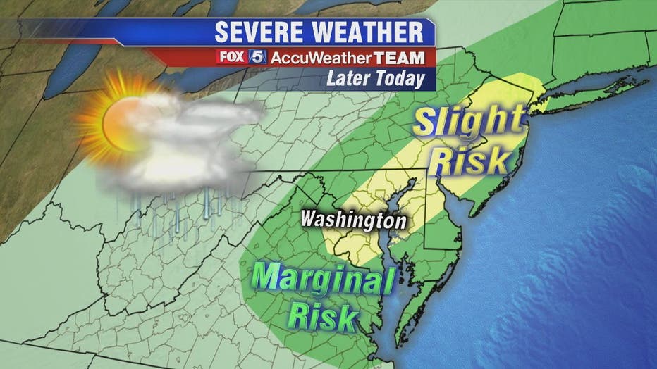
A slow moving cold front will head our direction and will likely bring storms to the I-95 corridor beginning sometime between 4 p.m. and 6 p.m. The storms could be severe and could bring gusty winds. The rain could linger into the late evening hours.
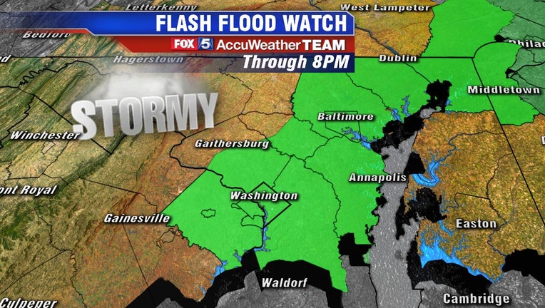
A Flash Flood Watch was issued for portions of Maryland, The District of Columbia, and northern Virginia until 8 p.m. Flash Floods can occur when an immense amount of rain falls in a short amount of time inundating overflow and drainage systems. Flash Flooding happens quickly and can catch people off guard.
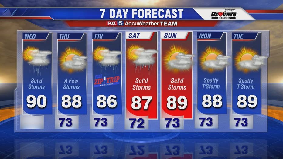
The cold front that will bring today's weather system will also bring the threat of storms to our region each day through the weekend.
Stay with FOX 5 on the app and online for weather updates:
Get the latest FOX 5 forecast here.
Check the latest Closings and Delays
Download the FOX 5 Weather App
Check the latest weather radars
Check for power outages in DC region
Stay up to date with the FOX 5 Weather Team on Twitter: