

Cloudy, cool with afternoon showers Monday; rain / snow mix possible Wednesday

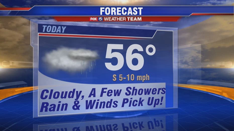
WASHINGTON - Monday will be wet but not a washout, says FOX 5's Gwen Tolbart. Grab that umbrella and expect rain and showers, heaviest by evening -- with some breaks in between. Regardless, travel safe on the roads!
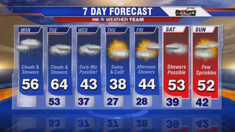
Warm air moves in Monday due to a southerly flow with temperatures heading to the upper 50s. The warm air sticks around for Tuesday which will be a soaker with heavier, more widespread rain.

Cloudy, cool with afternoon showers Monday; rain / snow mix possible Wednesday
Grab the umbrella! A cloudy and cool Monday with plenty of showers. Plus, we’re keeping an eye on the possibility of a rain / snow mix that could impact the D.C. area Wednesday.
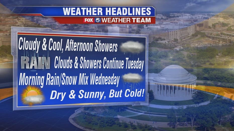
Big changes arrive by Tuesday night! We’ll keep a close eye on things into Wednesday morning, Gwen says. If the timing is right, the anticipated arrival of some very cold air as rain exits could result in some light snow or snow showers. It’s all in the timing!
Accumulations could possibly be highest west of the Blue Ridge Mountains where one to two inches are possible. A band from east central West Virginia into northwest West Virginia and northern Maryland with minor accumulation for the D.C. metro area is also possible. Road conditions will certainly be impacted. Stay weather alert!
There’s still a lot of uncertainty and this could easily change with less or higher amounts of accumulation for any given area -- so stay with the FOX 5 weather team for updates as we get them.
Stay with FOX 5 on the app and online for weather updates:
Get the latest FOX 5 forecast here.
Check the latest Closings and Delays
Download the FOX 5 DC News App for Local Breaking News and Weather
Download the FOX 5 Weather App
Check the latest weather radars
Check for power outages in DC region
Stay up to date with the FOX 5 Weather Team on Twitter: